
Introduction to GPS and GNSS
In the ever-expanding world of technology, GPS (Global Positioning System) and GNSS (Global Navigation Satellite Systems) are pivotal innovations. Initially developed for military navigation, these systems have transcended their original applications, embedding themselves into the fabric of daily life. Today, they do far more than merely pinpoint locations on a map; they are integral tools in various sectors, including agriculture, aviation, and urban planning, revolutionizing how we interact with our environment.
Understanding GPS and GNSS
The Basics of GPS
GPS is a satellite-based navigation system comprising a satellite network that sends precise signals, allowing receivers on the ground to calculate and display accurate location data. Initially developed by the U.S. Department of Defense, GPS was exclusively for military use during its early development stages. However, it was later opened for civilian use, leading to widespread adoption in countless applications.
The Expansion to GNSS
While GPS is often used interchangeably with GNSS, the latter encompasses a broader spectrum. GNSS includes systems like Russia’s GLONASS, the European Union’s Galileo, and China’s BeiDou. Each system works independently, but in concert, it provides more comprehensive global coverage and increased accuracy through cross-referencing multiple satellites from different systems.
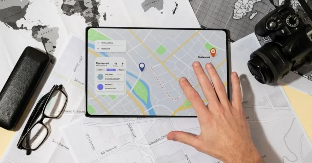
Applications of GPS and GNSS Technology
Navigation and Transportation
The most common use of GPS and GNSS technology remains in navigation. From driving cars on bustling city streets to piloting ships through treacherous waters, these technologies ensure safety and efficiency by providing real-time positional information. Moreover, they are essential for modern logistics, helping to manage and track the movement of goods globally. They also play a critical role in public transportation systems, enhancing route planning and reducing delays by optimising travel paths. Additionally, emergency response teams rely on these accurate location services to reach people in need quickly and effectively, demonstrating their vital importance in critical situations.
Environmental Monitoring and Management
GPS and GNSS technologies are vital tools in environmental conservation and management. They are used for tracking wildlife, monitoring changes in the earth’s surface, and managing natural disasters. By providing accurate data, these systems help scientists and conservationists make informed decisions leading to sustainable practices and policies.
Precision Agriculture
In agriculture, GPS and GNSS technologies have ushered in an era of precision farming. Farmers use these tools to plant seeds at precise locations and efficiently manage tractors and harvesters. This increases crop yields, reduces waste, and minimises environmental impact.
Urban Planning and Development
Urban planners utilise GPS and GNSS data to design more innovative and efficient cities. This includes everything from traffic management to the development of new infrastructure projects. Accurate geospatial data aids in optimally placing buildings, roads, and public transport systems, making cities more livable and reducing congestion.
The Future of GPS and GNSS
Innovations and Improvements
As technology progresses, GPS and GNSS systems continue to evolve. Innovations such as augmented reality (AR) navigation and autonomous vehicle technology rely heavily on improved accuracy and reliability of satellite data. Furthermore, advancements in satellite technology are expected to enhance the precision of these systems, opening up new possibilities for their application.
Challenges and Considerations
Despite their vast potential, GPS and GNSS systems face several challenges. Signal interference, both natural and artificial, can disrupt the accuracy of satellite data. Additionally, cybersecurity remains a significant concern, as these systems are crucial for many infrastructures, and their compromise could lead to severe consequences.
Impact on Emerging Markets
Emerging markets stand to gain immensely from adopting GPS and GNSS technologies. In regions like hemisphere Canada, where vast and often remote landscapes dominate, these technologies provide critical support in areas ranging from mining to forestry management, helping to boost local economies and improve quality of life.
Conclusion
GPS and GNSS technologies have evolved far beyond their initial military and navigational uses to become essential elements across various sectors. Their unparalleled ability to provide accurate and reliable location data has made them indispensable in our contemporary world. As technology advances and we continue to innovate and overcome various challenges, the potential for these technologies to further transform our lives and industries is truly boundless. With thoughtful integration, strategic development, and continuous improvement, GPS and GNSS will continue to shape the future of numerous industries, driving significant progress and fostering a better-connected, more efficient, and technologically advanced world. Their technological and socio-economic impact enables better decision-making and efficiency across global platforms.
If you find this article helpful, check out our blog for more informative content.